
Watershed Services
What WE Do
Taylor GeoServices (TGS) provides services in support of other firms or as a standalone company, offering a proven track record for assessment, design, permitting and management of streams, wetlands, and watersheds.
Watershed services are essential for the well-being of people and the environment. They provide many ecosystem services including nutrient cycling, carbon storage, erosion/sedimentation control, increased biodiversity, soil formation, wildlife movement corridors, water storage, water filtration, flood control, as well as reduced vulnerability to invasive species, the effects of climate change and other natural disasters.
Protecting healthy watersheds can reduce capital costs for water treatment plants and reduce damage to property and infrastructure due to flooding, thereby avoiding future costs. Managing and permitting streams, wetlands, and other watercourses are important for integrated water and land resource management.
Wetland Assessments & Delineations
Aquatic Macroinvertebrate Studies
Streambank Restorations
Water Quality Testing
Grant Writing Assistance
Case Studies.
Case studies
Contact us
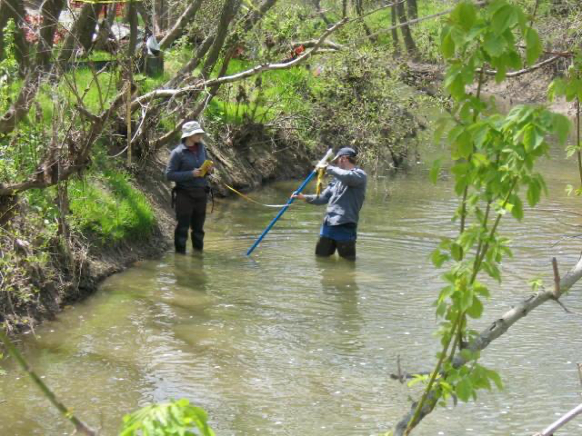
macroinvertebrate studies
Pennsylvania

The organisms inhabiting a stream can tell us a lot about the water chemistry and ecosystem quality of a stream or river. Their diversity, abundance, and sensitivity to environmental changes make them reliable bioindicators. By assessing the composition of these macroinvertebrate communities, we can gain insights into the impacts of pollution, habitat degradation, and other stressors on aquatic ecosystems.
Tree Planting Project
Bucks County, Pennsylvania

Taylor GeoServices (TGS) staff provided planning, coordination, oversight and planting of several re-vegetation and tree vitalize projects. Target planting areas were identified and native plants were selected based on the conditions of each area. GIS plans were used to identify site features, soil types, topography and show planting areas as well as selected plants. TGS staff also provided guidance and assisted the County and volunteers during the plantings.
PIDCOCK CREEK STREAMBANK STABILIZATION PROJECT
Bucks County, Pennsylvania
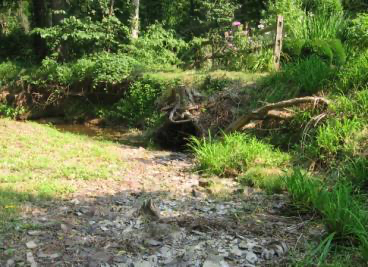
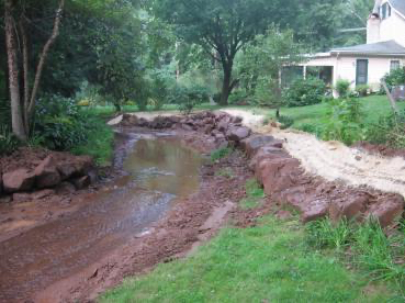
Taylor GeoServices (TGS) staff provided planning, coordination, and oversight to the Buck County Conservation District for their Pidcock Creek stream bank restoration.

Wissahickon Valley Watershed Association
Montgomery County, Pennsylvania

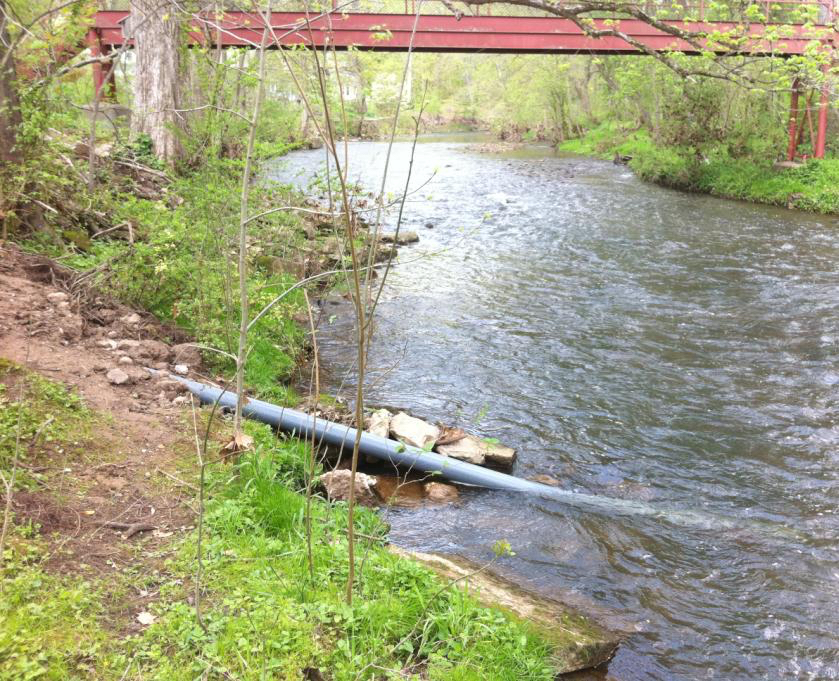

Taylor GeoServices (TGS) staff installed stream gauging equipment in the Wissahickon Creek to record real time water quality parameters to the watershed group. Using solar power and telemetry, data is uploaded to web based applications where staff is able to review water quality and provide hands on learning opportunities during their training programs.
Surface Water Quality Analysis and Aquatic Sampling
Pennsylvania

Wetland Delineations
Pennsylvania
Taylor GeoServices (TGS) staff assist in assessing and delineating wetlands for a Borough as part of their water well permitting and re-permitting projects. We recognize the significance of wetland assessments in the context of well permitting. Wetlands are ecologically sensitive areas, and our team is well-equipped to conduct wetland assessments and delineations.
This systematic process involves desktop and field surveys, vegetation analysis, soil assessments, and hydrological studies to accurately define the presence of a wetland and its boundaries within the project area. By understanding the extent and ecological functions of nearby wetlands, we can develop effective mitigation measures to minimize any adverse impacts arising from well construction or operation.
Location
Longitude: 75° 24.23'W
Elevation: 380+/- feet msl