Environmental Assessment
What WE Do
Taylor GeoServices (TGS) conducts Environmental Assessments to assist our clients with their environmental due diligence, transactions, and compliance. TGS staff have completed hundreds of Phase I and II ESAs since the 1980’s. Our Phase I ESA has always been comprehensive to satisfy industry and institution reporting standards. Our Phase II investigations are targeted and focused to be a cost effective and an informative supplement. Ultimately, an ESA is only as good as the effort and experience behind it. Our experience allows us to tailor scopes and provide sound and practical advice that clients can rely on to make informed decisions.
ENVIRONMENTAL SITE ASSESSMENTS
Project Locations Nationwide
However TGS does not apply a cookie cutter, one ESA format fits all projects approach. We will discuss the goals and purpose of each project with our client. If needed, based on known site history or our findings, additional scope requirements or intrusive investigation can be incorporated. When a potential concern is identified we strive to find answers that give our client sound decision-making information. Likewise, a modified work scope to meet time constraints or other client objectives may be sufficient in certain cases.
ESAs
Phase I
Phase II
Due Diligence
Risk Assessment
ACBM
Vapor Intrusion
Site Characterization
Our project locations range across the east coast and midwest from New Jersey to Michigan, and New England to Florida. Projects have included all spectrums of sites and conditions from inner city redevelopment projects, residential, commercial, and industrial properties, to undeveloped and rural farmland.
Clients are updated with our findings as the project proceeds, and provided with a comprehensive written Phase I ESA Report that complies with AAI and ASTM. Ultimately, an ESA is as good as the effort and experience behind it. TGS provides a thorough ESA with conclusions and recommendations that can be relied on.
Case Studies.
Case studies
PHASE I ESA – ENVIRONMENTAL LIABILITY PROTECTION

The Comprehensive Environmental Response, Compensation and Liability Act (CERCLA), also known as “Superfund,” was established to address abandoned hazardous waste sites. Among other things, CERCLA establishes a liability scheme for determining who can be held accountable for releases of hazardous substances.
Under CERCLA, persons may be held strictly liable for cleaning up hazardous substances at properties that they either currently own or operate or owned or operated in the past. Strict liability under CERCLA means that liability for environmental contamination may be assigned based solely on property ownership.
- Innocent landowners are persons who can demonstrate, among other requirements, that they “did not know and had no reason to know” prior to purchasing a property that any hazardous substance that is the subject of a release or threatened release was disposed of on, in, or at the property. Innocent landowners must meet the criteria set forth in CERCLA §101(40).
- Contiguous property owners are persons who own property that is contiguous or otherwise similarly situated to, a facility that is the only source of contamination found on his property. Such persons must demonstrate that they had “no reason to know” prior to purchasing a property that any hazardous substance that is the subject of a release or threatened release was disposed of on, in, or at the property. Contiguous property owners must comply with the criteria set forth in CERCLA §107(q)(1)(A).
- Bona fide prospective purchasers may buy property with knowledge of contamination, provided they bought the property after January 11, 2002 and meet the criteria set forth in CERCLA §101(40).
To claim protection from liability as an innocent landowner, contiguous property owner, or bona fide prospective purchaser, property owners, including state and local governments, must conduct all appropriate inquiries prior to acquiring the property.
“All Appropriate Inquiries,” or AAI is the process of conducting due diligence or a Phase I Environmental Site Assessment to determine prior uses and ownership of a property and assess conditions at the property that may be indicative of releases or threatened releases of hazardous substances at, on, in, or to the property. The standards and practices established as comprising “All Appropriate Inquiries” are set forth in regulations promulgated at 40 CFR Part 312.
EPA recognizes two ASTM International Standards as compliant with the AAI requirements: ASTM E1527 Standard Practice for Environmental Site Assessments: Phase I Environmental Site Assessment Process” and E2247“ Standard Practice for Environmental Site Assessments: Phase I Environmental Site Assessment Process for Forestland or Rural Property.”

PHASE I ESA – TYPICAL SCOPE OF WORK
Our ESA has always been comprehensive so that clients can make informed decisions, and we continually evolve to meet current industry standards. ESAs are conducted in conformance with ASTM’s “Standard Practice for Environmental Site Assessments: Phase I Environmental Site Assessment Process” (E1527) and EPA’s “All Appropriate Inquiries Final Rule, 40 CFR Part 312”. The typical work scope for a Phase I ESA will include the following:
Background information on the subject property and surrounding area is sought and reviewed, including:
- Federal and State regulatory records.
- Interviews with local officials.
- Interviews with owners, past owners, occupants, neighbors.
- Environmental questionnaire completed by property owners and operators.
- Previous environmental reports for the subject property.
- Water well records.
- Property ownership deeds, documents, records, plans.
- Recorded environmental liens, activity and use limitations.
- Maps of topography, geology, soils.
- Current and historic aerial photographs and satellite imagery.
- Maps of historic property use and topography.
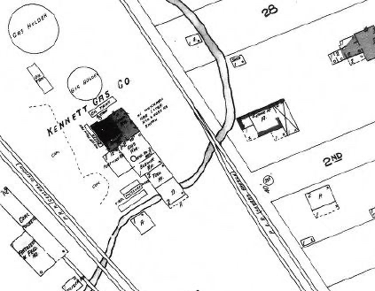
- Historic Sanborn Maps, Atlas, photographs.
- Relationship of purchase price to value of the property.
A site visit is conducted to visually observe current conditions, review available on-site documentation, and interview available site personnel. Representative and accessible portions of the property are visually observed and noted for such things as:
- General site setting, exterior observations, and interior observations.
- Evidence of staining, spills, odors, stressed vegetation, corrosion, pools of liquids, discolored water, releases, contamination, emissions, or ground surface alterations.
- Use, generation, storage, or discharge of hazardous substances or wastes.
- Existing or former underground and above ground storage tanks.
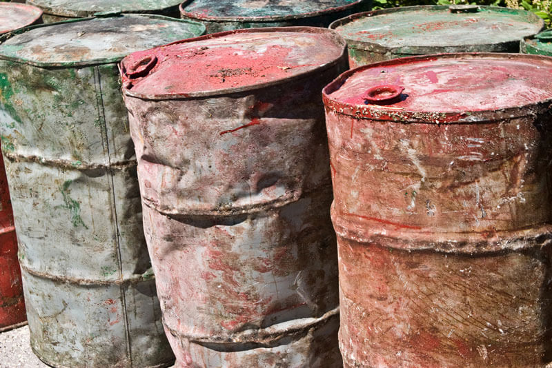
- Storage drums, PCB containing items, groundwater monitoring wells, pits, ponds, lagoons, drains, sumps, septic systems, dumping.
- Conditions and/or operations on adjacent properties that may adversely affect the environmental condition of the subject property.
- Physical imitations (e.g., snow-covered ground, limited access).
TGS provides a comprehensive written report that complies with AAI and ASTM. The report discusses the scope of work performed, findings, potential environmental concerns, and presents our opinion, significant data gaps, qualifications and recommendations for additional investigation. Any findings that would constitute recognized environmental conditions (RECs) associated with the subject property are contained in the report. The report includes a location map, figure and photographs showing current site conditions, along with other current and historic pertinent documentation obtained during the ESA such as maps, aerial photographs, and regulatory records. Clients are provided with an electronic copy of the report.

Brownfields Redevelopment of a Former
Fuel Oil Distribution Facility
Coatesville, Pennsylvania
Taylor GeoServices (TGS) provides professional services and project support in a variety of areas of municipal, industrial and hazardous waste landfill development and operation. We provide services in support of other firms or as a standalone company, offering a proven track record for site selection and design, permitting and daily operations.


A Brownfield property in Coatesville Pennsylvania had been historically used as a gasoline service station and bulk heating oil distribution terminal. Around 1990 the heating oil business was closed and the property was abandoned, but several storage tanks and the infrastructure associated with the oil terminal and historical uses remained. Between 1990 and 1997 the storage tanks were removed, however, limited work was done and the condition of the property deteriorated. The property was eventually sold and the new owner began to renovate the property and restore the existing buildings.
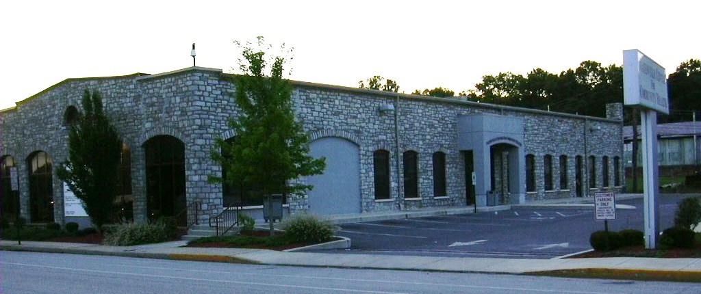
TGS was hired to address his environmental regulatory requirements. Located within a State designated Enterprise Zone, the property qualified as a Special Industrial Area under the Pennsylvania Land Recycling Act (Act 2). TGS assisted the owner in obtaining a grant for the environmental work, and in accordance with the SIA provisions of Act 2, a Baseline Remedial Investigation was conducted to characterize the site conditions. The findings from the investigation indicated there was not an imminent threat to human health or the environment associated with the property. The owner was provided with an Act 2 release of liability, and the historic building was redeveloped into a local community health center.
Location
Longitude: 75° 24.23'W
Elevation: 380+/- feet msl
